 |
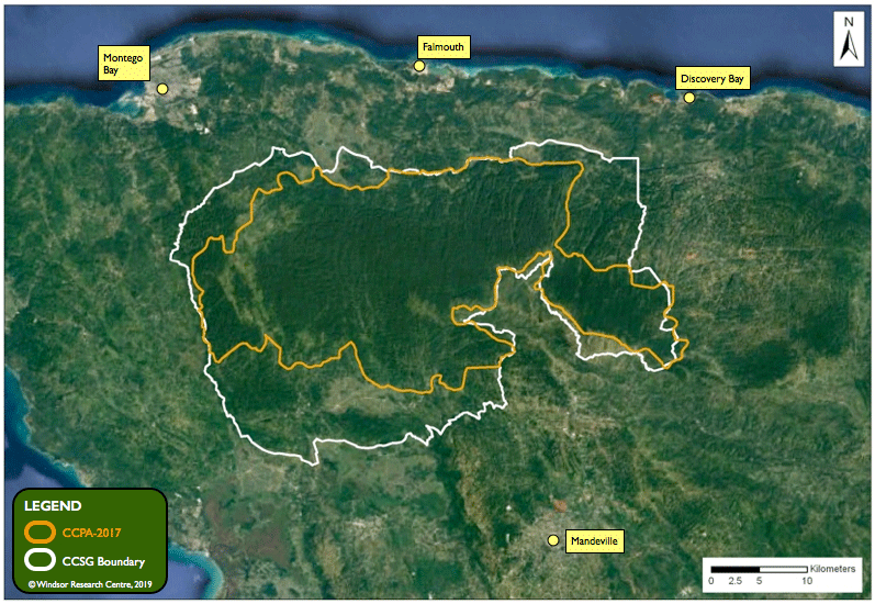
The 2017 Cockpit Country Protected Area (CCPA-2017) designated by the Prime Minister excludes important habitats in the northeast and southern flanks.
TECHNICAL NOTE: The CCPA-2017 boundary shown on the above map was created by Dr. Susan Koenig in ArcMap GIS software by hand-tracing the boundary presented by the Prime Minister to Parliament on November 21st, 2017. The first map we received (dated Jan-19-2018) via an ATI request showed minor changes from the map presented on November 2017. Whenever Dr. Koenig creates a new map showing the CCPA-2017 boundary, she always uses the original boundary of November 21st, 2017 to prevent confusion.
Because ground-truthing of the CCPA boundary is on-going, members of the public should always consult with Jamaica's Forestry Department for current information about the boundary.
UPDATE: August 31st, 2021
Forestry Department reports that that ground-truthing is completed for what they call the Cockpit Country Area Proposed for Protection (CCAPP). The perimter has a length of 253.27 km and it encloses 77,182 hectares of private and public lands. However, the National Land Agency has not been able to successfully engage a Commissioned Land Surveyor, so the boundary cannot be gazetted or closed to mining as yet.
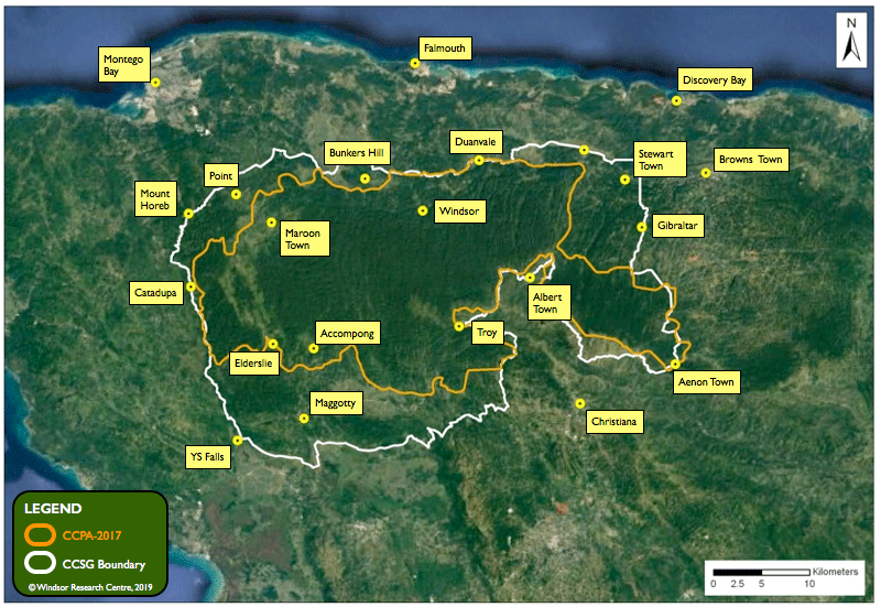
Here's the satellite map with more place names to help you locate your community.
 |
| Boundaries Home Page |