 |
In the Prime Minister's speech, it reads:
"In relation to the hydrological resources, the Water Resources Authority
identified and advised the Cabinet on hydrological features within then environs
of the Cockpit Country which required protection. In this regard, caves in the
north-east, in the Rio Bueno watershed, and in the north-west have been
included in the area to be protected."
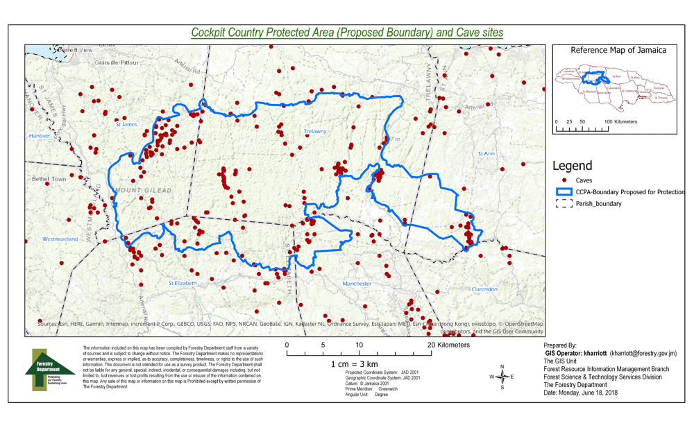
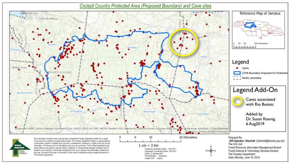
As shown by the higher-resolution map created by Forestry Department on June 18, 2018, the (Proposed Boundary) of the Cockpit Country Protected Area (CCPA) not only excludes numerous caves in the lanscape but as highlighted in the below map by the yellow circle, which Dr. Susan Koenig added to Forestry Department's map, the (CCPA) excludes specific caves associated with the Rio Bueno watershed. The Rio Bueno forms the northern border between the parishes of St. Ann and Trelawny.
| Boundaries Home Page |