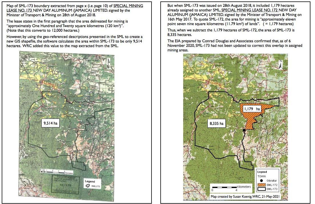
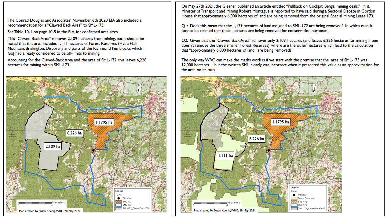
Unfortunately, the Gleaner article didn't include a map of the area to which the Minister was referring. But being as familiar as she is with the maps of the Special Mininig Leases (SMLs) in-and-around Cockpit Country, WRC's Dr. Susan Koenig was unable to do the "mental maths" to reconcile the Minister's statement. Where are these 6,000 hectares coming from?
Dr. Susan created the below series to help the public understand why she can't make the Minister's maths add-up. WRC looks forward to seeing any maps which Minister Montague or Mines and Geology Division can provide so as to clarify what areas are going to be removed from SML-173.
| UPDATE: January 25th, 2022
On October 25th, 2021, WRC's Dr. Susan Koenig submitted an Access-to-Information (ATI) application to the Ministry of Transport and Mining requesting a map showing the location boundary of the approximately 6,000 hectares of land which Minister Montague said would be removed from SML-173. After the first 30-day processing period ended, on November 29th, 2021 the Ministry requested an additional 30 days to provide the information. This addtional period is provided for under the ATI Act. In a letter dated January 17th, 2022, the Ministry informed Dr. Koenig that "At present, there is no map within the Ministry which shows the removal of approximately 6,000 hectares of lands from SML 173." The Ministry also noted that, "as published" (a phrase which Dr. Susan contrasts to what is written in the actual lease registered on August 28th, 2018 . . . ), SML-173 contains 8,335 hectares of land and that, if the Clawed-Back Area and Forested Areas (sic) which span approximately 2,109 hectares are omitted, then 6,226 hectares will remain as the size of the SML-173. The Ministry also wrote that, "of these 6,226 hectares, only approximately 20% will actually be impacted by mining activities." Mathematically, "approximately 20%" means that the Ministry estimates that approximately 1,300 hectares will be impacted by mining in SML-173. Please email Dr. Susan if you'd like to learn more about what "approximately 20%" represents in SML-173, especially in relation to an announcement by the CEO of NEPA, Mr. Peter Knight, on January 3rd, 2022 that 1,324 hectares are to be released to NJBP II for mining. Based on the Ministry's letter, Dr. Susan can only conclude that Ministry Montague presented inaccurate information to his colleagues at Gordon House on May 26th, 2021: 6,000 hectares ARE NOT going to be removed from SML-173 as per the Ministry of Transport and Mining in its letter dated January 17th, 2022. |
 |
 |
| Hub Page for EIAs of Cockpit Country |

